
THE SHORT ANSWER
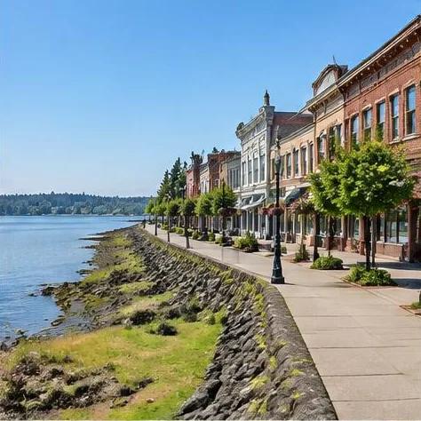
Steilacoom's shoreline includes Sunnyside Beach on Chambers Creek Road and Saltar's Point near Champion Street. These park areas offer different starting points for a drive inland. DuPont-Steilacoom Road leads toward JBLM, with Integrity Gate at Wharf Road providing a named Lewis North entrance to check against your duty location.Town of Steilacoom: Sunnyside Beach · Town of Steilacoom: Saltar's Point Park
Routes from Steilacoom to JBLM
The town identifies DuPont-Steilacoom Road as a connection toward I-5 and JBLM. Follow that road toward the Wharf Road intersection for Integrity Gate to Lewis North. If your destination is Lewis Main, check the separate DuPont Gate connection and current gate notices rather than assuming Integrity Gate serves your office.Town of Steilacoom road maps · JBLM gate locations and access
Public school districts serving Steilacoom
Steilacoom Historical names the town in its service area. The district can confirm the school assignment for a specific property.
Steilacoom Historical School District: OSPI Washington State Report CardDistrict service communities
Areas to compare in Steilacoom
Sunnyside Beach and Chambers Creek Road area
Sunnyside Beach is a town park on Chambers Creek Road with shoreline access, picnic tables and walking paths.Town of Steilacoom: Sunnyside Beach
Saltar's Point and Champion Street area
Saltar's Point Park has a picnic shelter and a footbridge over the railway tracks.Town of Steilacoom: Saltar's Point Park
Broker note
I would compare the street access from a Steilacoom shoreline home with the gate you will actually use. Keep the park setting and the duty route as separate checks.
CLEAR ANSWERS
Steilacoom PCS questions
Which route connects Steilacoom to JBLM?
The town identifies DuPont-Steilacoom Road as a connection toward I-5 and JBLM. Follow that road toward the Wharf Road intersection for Integrity Gate to Lewis North. If your destination is Lewis Main, check the separate DuPont Gate connection and current gate notices rather than assuming Integrity Gate serves your office.Town of Steilacoom road maps · JBLM gate locations and access
Which public school districts should I check for a Steilacoom address?
Steilacoom Historical names the town in its service area. The district can confirm the school assignment for a specific property.Steilacoom Historical School District: OSPI Washington State Report Card · District service communities
What should I know about Sunnyside Beach and Chambers Creek Road area in Steilacoom?
Sunnyside Beach is a town park on Chambers Creek Road with shoreline access, picnic tables and walking paths.Town of Steilacoom: Sunnyside Beach
What should I know about Saltar's Point and Champion Street area in Steilacoom?
Saltar's Point Park has a picnic shelter and a footbridge over the railway tracks.Town of Steilacoom: Saltar's Point Park